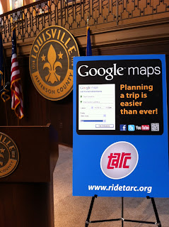
Mayor Greg Fischer, Innovation Director Ted Smith, TARC Director Barry Barker, and I were on hand at a city hall press conference last week to make the announcement.
Even better, TARC has made the wise decision to publish the link to their GTFS feed. That means the general public can grab the raw data just like Google, and create their own apps, websites, and tools using the data.
TARC's Public Transit Feed Data : http://googletransit.ridetarc.org/feed/
Google grabs TARC's updated transit feed every Thursday.
Google grabs TARC's updated transit feed every Thursday.
Louisville Transportation Camp
To help facilitate the use of this data, I am hosting a free Louisville Transportation Camp. This camp will introduce this data to local developers, and we will brainstorm app ideas, creating a prototype app by the end of the camp.
We will also explore Louisville PARC's newly opened data, and all the data available on Metro Mapper (using the Your Mapper API). A TARC technical representative will be on hand. And afterwards we'll ride TARC to a nearby watering hole.
Please sign up and spread the word. It's a free event, but if you can donate if you'd like to be listed as a Supporter. If your company wants to sponsor the event, they can do it on the event page or sponsor by providing swag, food, or supplies.
Thanks! Open transit data for Louisville's been a long time coming, and I'm glad it's here, so let's make the most of it. Post in the comments your experiences using the data to get around.


