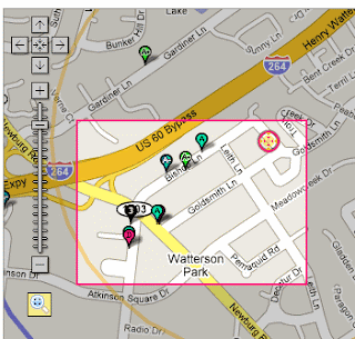
We've updated the crime map to include the newest report data for Metro Louisville and Jefferson County, through December 12, 2007. Use the Date Range filter on the left of the map to see what's newly occurred around your home or office.
For each crime, click the "Details" button in the popup to see more details about the case, including a description of what happened.
We've also updated our Crime Mapplet, so those of you that use it will see the new crimes automatically.
Note: This will probably be the last time we post in the blog about a crime update. Just expect to see them monthly. If you want to follow our data updates as they happen, and for other minor notices and info, please follow our Twitter stream.
Interactive maps for the Louisville Metro and Kentucky areas.
Wednesday, December 19, 2007
Monday, November 12, 2007
New Feature: Streamlined Local Search
Now at the bottom left of every map there is a new improved local search box.  You can type in a term or business name and you will see the closest 10 results directly on the map you are viewing. So if you search for 'security' after doing a crime search, you'd see the nearest companies that can help you out!


Tuesday, November 06, 2007
Crime Map Updated to November
We've updated the crime map to include the newest report data for Metro Louisville and Jefferson County, through October 29, 2007. Use the Date Range filter on the map to see what's newly occurred around your home or office.
For each crime, click the "Details" button in the popup to see more details about the case, including a description of what happened.
We've also updated our Crime Mapplet, so those of you that use it will see the new crimes automatically.
For each crime, click the "Details" button in the popup to see more details about the case, including a description of what happened.
We've also updated our Crime Mapplet, so those of you that use it will see the new crimes automatically.
Thursday, October 11, 2007
Twitter Statuses
Follow Metro Mapper's daily updates with Twitter! Track our progress in your Twitter stream. Some people have found us on Twitter through web searches, so now it's official.
Tuesday, October 09, 2007
New Feature: Bookmark, Email, and Save Your Favorite Maps
You can now bookmark your favorite maps and searches for later, and send them to your friends by email! At the top of our maps is a new option to create a bookmark, which takes a snapshot of your search address, filter options, and where you've zoomed, and saves it to your account. You can then bookmark it and send the link to others. They'll see the search and view you see.
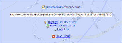
In order to save your bookmarks, you'll need a free account. Register with us, and then when you login again, from any computer, you'll have all of your favorite bookmarks ready for you to view or email to others. Your account also lets you take any of our maps and put them on your own website or blog.

In order to save your bookmarks, you'll need a free account. Register with us, and then when you login again, from any computer, you'll have all of your favorite bookmarks ready for you to view or email to others. Your account also lets you take any of our maps and put them on your own website or blog.
Friday, September 21, 2007
Crime, Crime, Crime! Updated, Faster, and More Details
Finally, we were able to get the newest crime data from the LMPD and have made a major update to the crime map. We now have a detailed description of each crime, twice the amount of data, and the maps load about 20 times faster. The reported crimes goes from 2003 through August 2007 and will be updated monthly from now on.
 For each crime, just click the "Details" button to see more details about the case, including a description of what happened. We've found that you can spend hours just reading the details of what has happened around town and in your neighborhood.
 We've also updated our Crime Mapplet, so those of use that use it will see the new crimes automatically.
In addition, if you have put any crime maps in your website or blog with our Create Maps feature, then these will automatically be updated as well.
For each crime, just click the "Details" button to see more details about the case, including a description of what happened. We've found that you can spend hours just reading the details of what has happened around town and in your neighborhood.We've also updated our Crime Mapplet, so those of use that use it will see the new crimes automatically.In addition, if you have put any crime maps in your website or blog with our Create Maps feature, then these will automatically be updated as well.
Tuesday, September 11, 2007
Major Server Update
Last night we preformed a major upgrade to all of our servers, including the web and database and DNS servers. The upgrade increased capacity, bandwidth, processing speed and other things.
The effect is that all the maps should be created even faster than before.
The site and our servers were down for a few hours, for the first time since launching in March of 2006. If you had any issues or couldn't reach the site, we apologize. There may still be lingering issues, and we'll keep you posted in this blog and across the top nav of the site.
Thanks and enjoy the improvements!
Tuesday, August 21, 2007
Partner: Louisville.com Dining Map
Metro Mapper has teamed up with Louisville.com to put their Louisville eatery database on a searchable Metro Mapper map and in their online Dining Guide. Check it out at Louisville.com!

"It's no secret - Louisville has developed a reputation for great food. From white table cloth and crystal fine dining to lick-your-fingers Kentucky barbecue, if it's food, it's in Louisville. We've partnered up with Louisville Magazine to amass the most complete database of Louisville eateries on the web to help you make your dining out choice easier. We've included a complete picture of the dining scene in Louisville - all cuisines, geographical locations, kid friendly places - so dig in and bear down!"
- Louisville.com
Friday, August 10, 2007
Featured Map: Kentucky Bridge Safety
Many people are interested in knowing how safe their bridges are after the tragic Minneapolis I-35W collapse. We've put together a Bridge Safety map for the state of Kentucky, with the most recent status of over 15,000 bridges.
This map shows the status of every bridge or overpass in Kentucky and inlcudes when it was inspected, year built, and daily vehicle traffic. The status can be Structurally Deficient, Functionally Obsolete, Not Deficient or Not Applicable, and each bridge is also given an overall rating by FHWA from 1-100%, with 100 being the best.

This map plots information from the National Bridge Inventory from the Federal Highway Administration site.
Friday, August 03, 2007
New Maps: 100 Most Recent and Most Popular
Take a peek at what other people are searching for on Metro Mapper with two new maps. One map shows you in real-time the last 100 searches made, and another shows you the most popular locations of all time. The top 20 get their own black marker (labeled 1 to 20).

If something is going on right now in Louisville related to housing, crime, sex offenders, or restaurants, watch as everyone's searches cluster around that area!
A great feature of the maps are the icons across the bottom. Hover your mouse over them to see what they do. Here's a breakdown:
 Make Map Larger: If this map is on another website, click this to see larger version on Metro Mapper
 Link to Map: Create a link to this map, which you can bookmark, or send to others. The markers will keep getting updated when you revisit this link.
 Email this Map: Creates an email with a link to this map inside. Send it to your friends so they can see what you see.
 Open in Google Earth: This opens the markers in the 3D program, Google Earth. You can save this so you see it everytime you open it later. This links to the KML data file, so you can use that in other programs if you are a developer.
 Initial View: Return to the initial view of this map, in case you've been panning and zooming the map around and got lost.
 Refresh Map Data: Grabs the most recent data quickly and on-the-fly, so you don't have to refresh the whole page to see the newest results.
If something is going on right now in Louisville related to housing, crime, sex offenders, or restaurants, watch as everyone's searches cluster around that area!
A great feature of the maps are the icons across the bottom. Hover your mouse over them to see what they do. Here's a breakdown:
Make Map Larger: If this map is on another website, click this to see larger version on Metro MapperThursday, August 02, 2007
Louisville Metro Police Department: MetroWatch Map
The LMPD launched a new service yesterday called MetroWatch. It's an interactive online crime mapping tool that maps neighborhood crimes reported during the last 30 days. It's an okay first stab at a public mapping service, but I think there are a number of issues with the implementation.
What Metro Mapper does better:
What do you think?
What Metro Mapper does better:
- More Data. Has 2-4 years of data available, instead of 30 days.
- More Crimes. Shows all crimes reported, instead of just some.
- MetroWatch: Assault, Auto Theft, Burglary, Homicide, Robbery, Theft, Vandalism
- Metro Mapper: Arson, Homicide, Assault, Kidnapping, Bribery, Larceny/Theft, Burglary, Motor Vehicle Theft, Vandalism, Pornography, Drugs/Narcotics, Prostitution, Embezzlement, Robbery, Blackmail, Sex: Forcible, Forgery, Sex: Nonforcible, Fraud, Stolen Property, Gambling, Weapon Violations, Miscellaneous
- Faster. Shows results immediately, and once loaded allows instantaneous panning and zooming on the maps, instead of waiting for each map change to load.
- More Information. MetroWatch only shows the address of the report, where Metro Mapper shows address, location type, date and time, offender info (sex, race, age), sub-category of crime, counts of crime, and distance from your address.
- Search Options. Metro Mapper lets you see only the types of crime you want to see. You filter your search with start and end date, types of crime, offender info, crime severity, and locations of the crime. For example, you could get a map of only crimes reported in the last year relating to sexual abuse at bars or restaurants where the offender is a white male.
- Extra Overlays. With our Mapplets, you can overlay the crime reports with the location of registered sex offenders in your neighborhood. Or if you are looking for a home, see the most recent homes for sale, then show the crimes that occurred around that home. And then you can email the map to your friends, or view it in Google Earth.
- Quicker Updates. Until the LMPD puts their publicly available crime data on their public website (like other US cities do) for all to use (instead of just sending it privately to LOJIC), my data will be a few days/weeks/months out of date. Requests for data can take a long time due to the LMPD process and paperwork.
- Street Names. Since LOJIC's maps are city run, they can update their street names quickly, so if a name changes, it's reflected right away. Names don't change that much, so I'm really grasping at straws here. Google's maps are from a national database, so their updates are a bit slower.
What do you think?
Wednesday, July 25, 2007
Updated Map: Sex Offenders for All of Kentucky
The sex offender map now has data for the entire state of Kentucky, instead of just Louisville. You can use the "Center of Map" feature to move the map to your city, or try the new mapplet to do an address search. If you've already used the mapplet, the state-wide data has been added automatically!
Tuesday, July 24, 2007
New Mapplets: Traffic Cams, Historic Sites
Two new mapplets for you to use, one for historic sites and one for live traffic cams. The historic sites cover all places in the states of Kentucky and Indiana. The traffic cameras are live images of downtown Louisville and the expressways.
Add them to your maps page from the Google Maps Directory.


Add them to your maps page from the Google Maps Directory.
Wednesday, July 18, 2007
New Mapplets: Crime, Sex Offenders, Real Estate
We've added 3 new mapplets for crime, sex offenders, and daily updated real estate listings. Mapplets give you the power to overlay Metro Mapper's, other people's, and your own data all at once on the same map. We keep it up to date, and you view the results all at once on your own Google map, available from any computer!
Add them to your maps page from the Google Maps Directory.


Add them to your maps page from the Google Maps Directory.
Friday, June 29, 2007
Mapplet: Restaurants on your own map!
This is a new feature for all you experimental types out there. You can now see a searchable restaurant map on a Google map... with other custom information at the same time! Did you ever want to see the restaurants from Metro Mapper, and then overlay gas station prices, movie times, and local photos on the same map? Now you can with Google's Mapplets.

Just click the image above, then click 'Add to Maps' and you'll get our searchable restaurant overlay. Then, go back an add some popular mapplets to view at the same time, like Gas Prices, Movie Times, and Local Photos.
The cool thing is that whenever we update our restaurant data, you'll get to see the newest restaurants on your custom map automatically. We'll be adding the rest of Metro Mappers maps soon. Enjoy, and learn more about it here.
As a bonus, note that you can save your results by click the Link to, Email, and Google Earth buttons at the bottom of the mapplet. This will let you bookmark your search, email your friends what you've found, and even view it in 3D in Google Earth.
Sunday, June 17, 2007
New Feature: Google Traffic on Every Map
You can now overlay the current traffic conditions on every Metro Mapper map, even within our own traffic map. The traffic info comes from GPS devices that Google tracks nationally.

It's not as accurate as our local Louisville traffic map. but it can provide a comparison and show some areas we can't cover. Now you won't be late to your restaurant reservation or home appointment.

It's not as accurate as our local Louisville traffic map. but it can provide a comparison and show some areas we can't cover. Now you won't be late to your restaurant reservation or home appointment.
New Feature: Interactive Zoom
Have you ever wanted to zoom in on a cluster of markers, but were annoyed that you had to click zoom, then drag to recenter, then repeat? Well now you can click the Zoom icon on the left side of the map and interactively select an area to zoom in on!
 The map will automatically zoom into the area you want to see in more detail.
 The map will automatically zoom into the area you want to see in more detail.
Tuesday, June 12, 2007
New Feature: Local Search Results on Maps
Built into each map is the new ability to search for anything you want (pizza, hardware, bars, groceries) and have the closest 10 results appear along with your Metro Mapper results! The search and results are an overlay on the map, so you won't loose what you are looking at. Then you can browse the results, see more, and even get driving directions.

Look for at at the bottom left each map.

Look for at at the bottom left each map.
Friday, June 01, 2007
Updated Map: Homes for Sale
Big news! The Real Estate homes for sale map is back online, and way better than ever! It's now updated nightly, has more information for each listing, and more search options.

Leave a comment and let us know what you think. I know some people wrote that they missed the old home search, so I hope this new one will be better and more useful for them.

Leave a comment and let us know what you think. I know some people wrote that they missed the old home search, so I hope this new one will be better and more useful for them.
Thursday, April 26, 2007
Updated Map: Historic Sites. ALL Sites in KY and IN
The Historic Sites Map now includes every site in Kentucky and Indiana, over 5,000 monuments, buildings, districts, and areas. If you want to search an area outside of Louisville, use the "Center of Map" tool to zoom and drag the map to any location in Kentucky or Indiana; your search will be centered around that point.
In addition, we've plotted the outlines of historic areas, like the Highlands in Louisville. These areas are the red points and have an associated red boundary and shading. Single historic places are marked with a blue point.
Enjoy!
In addition, we've plotted the outlines of historic areas, like the Highlands in Louisville. These areas are the red points and have an associated red boundary and shading. Single historic places are marked with a blue point.
Enjoy!
Monday, April 16, 2007
Updated Map: Derby 2007 Events and Routes
The First Annual Kentucky Derby Map has been updated to include charity and commerical events, as well as a detailed route of the Mini Marathon and Full Marathons.

More events will be added as they become publicized, including all Chow Wagon locations. Also, we'll be overlaying more routes, like the Pegasus Parade, and Triple Crown of Running. If you know of an event that is not listed on our map, please contact us.

More events will be added as they become publicized, including all Chow Wagon locations. Also, we'll be overlaying more routes, like the Pegasus Parade, and Triple Crown of Running. If you know of an event that is not listed on our map, please contact us.
Friday, April 06, 2007
New Map: Derby 2007
The 2007 Kentucky Derby events are now all together in a new map! With only a few weeks left before the 133rd running of the Run for the Roses at Churchill Downs, Metro Mapper has launched its First Annual Derby Map.

Now you can see where the dozens of official and un-offical events are taking place in the beautiful city of Louisville. We'll be adding more events and details in the coming days. We think it's great to see the diversity of events and locations spread over the city. Show it to your local friends and out of town visitors.

Now you can see where the dozens of official and un-offical events are taking place in the beautiful city of Louisville. We'll be adding more events and details in the coming days. We think it's great to see the diversity of events and locations spread over the city. Show it to your local friends and out of town visitors.
Friday, March 23, 2007
Updated Map: Traffic
The Traffic Cam map has been updated to include lots more useful information. In addition to the cameras, you can also see the live messages on the traffic signs and the current highway speeds! The highway speed overlays go from green to yellow to red depending on the delay.

Enjoy the new features and let's hope it gets you to where you are going quicker.
Subscribe to:
Posts (Atom)